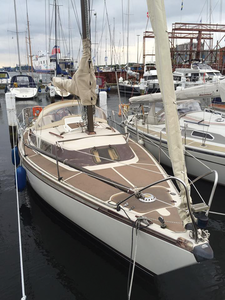
Raspberry Pi navigation on the open seas

Short Audition

The results of the first test were very positive; avNav received AIS data, and the radio knew the position of the boat. Therefore, data transmission via RS232 and the USB-to-serial adapter worked well (Figure 3).

Figure 3: The setup for the first on-board test.

After installing cables on board, four D-Sub connectors hung from a swallow's nest, including GPS from a Furuno GP32, AIS from the radio, speed information from the speedometer, and depth indicators from the echo sounder. To avoid taking over all of the USB connectors on the Rasp Pi with on-board electronics, I decided to use an adapter to lead four serial connectors to one USB port [4]. Afterward, it was time to configure the Rasp Pi, which turned out to be easy because of the preparatory work performed by Vogel.

Readying the Rasp Pi

As mentioned earlier, Vogel has put some ready-to-use images of avNav on his website [5]. All I needed was a computer with an SD card reader and a Rasp Pi with an SD card of at least 32GB. The navigational charts go on this card later, so it has to have enough space. Install the avNav image on the SD card as usual [6]; then, insert the card into the Rasp Pi.

The system is preconfigured. Once connected, a Raspberry Pi 3 (RPi3) immediately makes its own WiFi capability available via the integrated WiFi interface to display devices, such as a tablet or smartphone. When the devices are connected, the user can immediately open the address https://avnav.avnav.de (Figure 4). This address does not actually exist; therefore, opening it involves a rather clumsy hack in the form of a captured DNS request. This approach works well, with practically no need for any further configuration.

Figure 4: avNav comes from the manufacturer ready to use as a boat navigational system thanks to a web application. Here it is shown on the Dahme River in Berlin.

Once the on-board devices have been connected via serial USB converters to the Rasp Pi, avNav immediately displays relevant information in the web interface, such as the current GPS location and available AIS data. By the way, it is noteworthy that a series of configurable parameters for serial communication is conducted via RS232 or RS422 for things like the port speed. Vogel has taught avNav to figure out port parameters through trial and error. Therefore, from the captain's point of view, plugging in the corresponding devices is usually sufficient; avNav automatically takes care of the rest.

Buy this article as PDF

Express-Checkout as PDF

Pages: 8

Price $2.95
(incl. VAT)

Buy Raspberry Pi Geek

SINGLE ISSUES
 
SUBSCRIPTIONS
 
TABLET & SMARTPHONE APPS
Get it on Google Play

US / Canada

Get it on Google Play

UK / Australia

Related content

  • Maritime navigation with a Rasp Pi and OpenCPN

    The Raspberry Pi is ideally suited to serve as the basis for a low-cost navigation system. OpenCPN software and a GPS receiver are all you need to add.

  • Using the Raspberry Pi for a multimedia center on your boat

    Due to its diminutive size and minimal power needs, the Raspberry Pi works well as a multimedia center on boats or in RVs.

  • Welcome

    It is rumored that Thomas Edison tested thousands of filaments for an incandescent lamp before he produced the first commercially viable electric light bulb, and I imagine his is not a unique experience. Building mock-ups and working models exposes the weaknesses and strengths of a design, which prepares you to make a better version, then a better version, until you have found the right combination of materials, components, configuration, and cost.